





































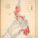
PHILIPPINES - GENERAL - DEEP SEA TRENCH - 1899 Original Antique Map
PHP 1,950

Lightly used

Mailing

Bacolod City
Condition
Description
Posted
1 month ago
- Old map of the Philippines - Features 'Islas Filipinas Mapa Orográfico Observatorio de Manila' - Ideal for collectors or history buffs Original 1899 Philippines Islands Map Title:- " Mapa Orografico " Publication & Date:- issued in Washington, USA 1899-1900 for " Atlas de Filipinas - Colleccion de 30 Mapas Trabajados por delineantes filipinos bajo la direccion Del p.jose Algue, S.J. Director Del Observatorio De Manila -- Atlas of the Philippine Islands" " After the Spanish-American War of 1898, at the Treaty of Paris, The Philippine Islands were sold by Spain to the U.S. for $20 million to cover infrastructure owned by Spain. A new series of maps, of the islands, were being prepared at that time by the Jesuit Observatory in Manila, supervised by its director, José P. Algué. These maps were voluntarily transferred to the Americans, who published them as this atlas." Description:- Attractive and well detailed. Long deep Sea Trench shown to right, depth gauge listed. Very slight crease lower right, also note lower extreme corner has been damaged into border. Reverse is blank - suitable for framing. Condition & Size:- Clean and good condition - printed area 13 "x 14" - plus margins. Printed color
Delivery
Mailing & Delivery
Meet the seller
Kubo Art & Antiques
Profile details
5.0
7 reviews
4 years
on Carousell
5.0

thank you so much cool seller
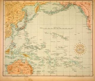
Antique Pacific Ocean Map - Japan, Australia, Philippines
PHP 1,250

Easy to deal with

Philippine Islands - CATANDUANES - 1899 Original Antique Map
PHP 1,450

What others also search for
Similar listings


classyaffordabest
8 days ago





madiscollectibles
10 days ago




winstonsheebamonna
16 days ago











epicwolf.7df65e
23 days ago

ka_luma
23 days ago





iamnathan0606
26 days ago

winstonsheebamonna
26 days ago


tommyfindstagum
26 days ago


jjantiques
26 days ago

sissymissy1527
28 days ago




mzreas
30 days ago



jamsbookshelf
30 days ago

honhonliz
30 days ago